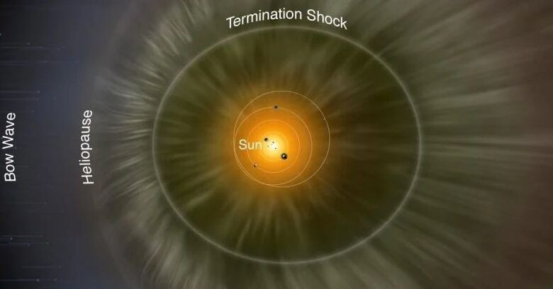
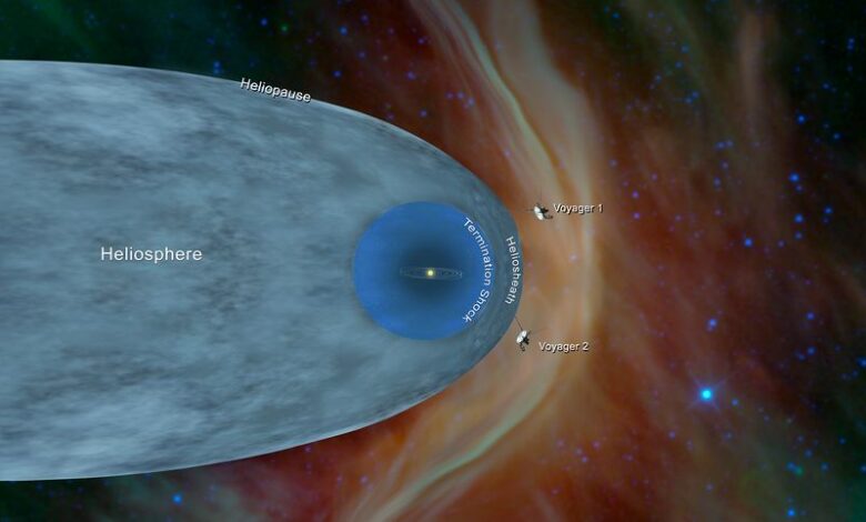
Diagram of the heliosphere. Photo Credit: NASA/IBEX/Adler Planetarium
Technology USAScientists Create First-Ever 3D Map of a Major Region of Space
Astronomers associated with the United States’ NASA have finally been able to identify the shape of the heliosphere, the region surrounding the sun created by the solar wind, thus helping us understand what constitutes the Solar System’s environment.
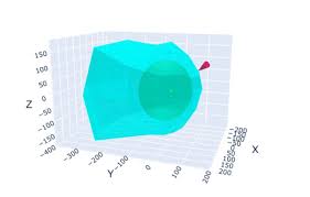
“Physics models have theorized this boundary for years,” says astronomer Dan Reisenfeld of Los Alamos National Laboratory. “But this is the first time we’ve actually been able to measure it and make a three-dimensional map of it.”
The 3D map has been created thanks to data collected from NASA’s Earth-orbiting Interstellar Boundary Explorer (IBEX) satellite after it did a full solar cycle, from 2009 to 2019. The signal decoded is emitted like a dolphin’s sonar use to map its surroundings. “The solar wind ‘signal’ sent out by the Sun varies in strength, forming a unique pattern,” adds Reisenfeld. As it turns out, the heliosphere is shaped like a bullet, but the length of its tail cannot be determined yet. The IBEX mission will continue until 2025, gathering more information to refine the shape even more. The research can be found in The Astrophysical Journal Supplement Series.