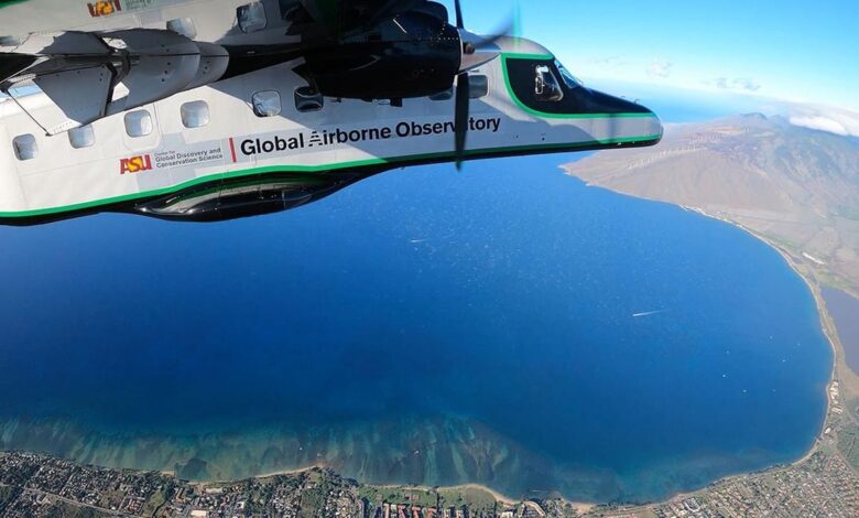
The Arizona State University Global Airborne Observatory on a mapping mission over north Maui Island coast. Photo Credit: Center for Global Discovery and Conservation Science / Arizona State University
Environment USAHow (and Why?) They Mapped All of Hawaii’s Coral
Thanks to a group of scientists who created the first aerial map of the coral reefs that surround the main islands of Hawaii, the United States, reef conservation gains a tool that can potentially be helpful around the globe.
“Never before has there been such a detailed and synoptic view of live corals at this scale,” says Jamison Gove of the National Oceanic and Atmospheric Administration and co-author of the study. “With these new maps, we have a better shot at protecting what we have while focusing on where to improve conditions for corals and the myriad of species that depend upon corals,” adds study coauthor and head of Hawaii’s Division of Aquatic Resources Brian Neilson.
The team of scientists from the Arizona State University’s Center for Global Discovery and Conservation Science did a mapping of coral reefs that could help policymakers to determine which reef to protect, or which area to restore. In order to create that map, they used laser-guided imaging spectroscopy to show the geographic distribution of the coral along the islands at 16 meters of depth, and expose where corals were impacted by human activity and to what extent. The climate crisis plays a big part in ocean acidification and coral bleaching, and if no measures are taken, up to 75% of the world’s coral reefs could be in danger by 2050.