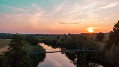
Birds are seen at the Yellow River Delta wetlands in autumn on October 22, 2021 in Dongying, Shandong Province of China. Photo Credit: VCG/Getty Images
Environment ChinaCoastal Wetlands Are Doing Great: Satellite Images Can Prove It!
Thanks to satellite imagery, it is proven that China’s coastal wetlands have been improving since 2012, and several projects aimed at restoring and conserving these vital ecosystems have been rolled out.
“It’s encouraging that we start to see some improvement in coastal wetlands,” says Xiangming Xiao of the University of Oklahoma, lead author of the study. “It’s demonstrated that there is still hope… for the conservation and restoration [of China’s wetlands].”
A series of maps made from satellite imagery shows that three kinds of coastal wetland regions — tidal flats, salt marshes, and mangroves — first experienced a decrease from 1984 to 2011, but rebounded after 2012. Wetlands are crucial to protect coastlines from floodings and storms, they are home to a large variety of vegetal and animal species, and they can sequester carbon. Since the 1990s, the importance of coastal wetlands is recognized by Chinese authorities, and projects are developed to restore and conserve them, like the National Coastal Shelterbelt System Construction Project Plan — launched in 2017 to restore 48,650 hectares of mangrove forests — to be completed by 2025.