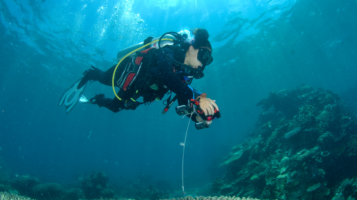
Environmental scientist Alexandra Ordoñez Alvarez from the University of Queensland collects data in Far Northern Great Barrier Reef on Ashmore Bank. Photo Credit: Courtesy of Arizona State University
Environment USAFirst-Ever Coral Reef World Map: a Conservation Game-Changer
A team of researchers affiliated with Arizona State University, United States, created the world’s first map of all the coral reefs around the globe, a tool to better monitor and protect an ecosystem highly threatened by climate change.
“There are countries, organizations and government agencies in the world that don’t have a map of their reefs […] so these maps will help people by basically giving a baseline to better assess where action is needed,” says marine scientist Chris Roelfsema, who led the mapping process for the Allen Coral Atlas. “We can better make plans for marine protected areas.”
The Allen Coral Atlas, whose name comes from Paul Allen, co-founder of Microsoft who funded the project, combines some 2 million satellite images of 98,000 square miles of coral reefs in water up to 15 meters deep to create high-resolution maps. The Atlas also takes into account data, such as waves turbidity, and sand or rocks, that interact with coral reefs. Coral reefs cover merely 1% of the planet’s ocean, yet more than a quarter of the ocean’s wildlife depend on this ecosystem. More than 30 countries use the atlas’ data to develop their conservation projects.